Cyanobacteria Algal Blooms and Remote Sensing
What is remote sensing?
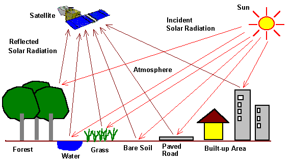
Remote sensing Is a science, art or technology to obtain information about a body or a phenomenon on the earth from different heights or distances using variety of an accurate sensors which are mounted in the aircraft, satellites, and spacecraft. Remote sensors collect data by detecting the energy that is reflected from Earth.
Applications of remote sensing teachnology:
Some of the areas in which satellite remote sensing technology has been applied are as follows:
• Agriculture
• Disaster monitoring and
mitigation
• Surveying and urban planning
• Water resource management
• Environmental monitoring
• National spatial data infrastructure
• Infrastructure development planning
and monitoring
• Mineral exploration
• Telecommunication
• Coastal eco-system monitoring
History of remote sensing:
Aerial photography is the early beginning of the field of remote sensing in 1800s. The term, “remote sensing,” was first introduced in 1960 by Evelyn L. Pruitt of the U.S. Office of Naval Research. However, the first aerial photograph was taken in 1858, 102 years before the term “remote sensing” came into existence. Credit: © 2014 Paul R. Baumann. Read more...

COPYRIGHT © 2014 Paul R. Baumann.
Kinds of remote sensors:
Airborne and spaceborne sensors can be classified as either "active" or "passive," according to energy soucre which feeds sensors with reflected radiation. Active sensors rely on their own source of electromagnetic energy whereas passive ones depend on the naturally-occurring energy like reflected solar radiation. These some examples of active remote sensing technologies include radar and airborne light detection and ranging (lidar). Passive remote sensing technologies include aerial photography and satellite imagery. Read more...

Examples of different types of remotely sensed data. Clockwise from upper left: Interferometric Synthetic Aperture Radar (IFSAR) data, topographic and bathymetric lidar data, digital photography, and hyperspectral imagery, all of coastal regions. Click image for larger view. Credit: NOAA
The importance of remote sensing in detecting harmful of algal blooms:
Remote sensing play a key role in detecting the harmful of algal blooms in water bodies, with assistance with additional field tests. A study done by Dr. Brian Lapointe and his research assistant Brad Bedford from Harbor Branch's Center for Marine Ecosystem Health (April 13, 2010), on the largest rivers in southwest Florida: the Caloosahatchee River off Ft. Myers and Shark River near Cape Sable. They began field studies in order to integrate water quality sampling with satellite remote sensing data to enhance ecosystem management of South Florida Rivers and coastal habitats.
The study examined the ecological effects of discharges from the two largest rivers in southwest Florida: the Caloosahatchee River off Ft. Myers and Shark River near Cape Sable.
Accodring to Dr. Brian Lapointe and his colleagues (April 13, 2010), "Field studies involved sampling waters along offshore transects for salinity, ammonium, urea, nitrate, phosphate, total nitrogen, total phosphorus, turbidity, color, chlorophyll A, and phytoplankton taxa". This study directly addressed two of NASA's priority issues identified by the Gulf of Mexico Alliance that target water quality and nutrient reduction. For more details, watch the below youtube.
Credit: Florida Atlantic University & Harbor Branch Oceanographic Institute (Jun 24, 2010)
Spectral properties of Cyanobacteria algal blooms:
Remote sensing techniques can be used to detect optical properties of cyanobacteria concentration in water bodies. Moreover, remote sensing images are frequently used to study the distribution of algae blooms based on the fact that algal pigments affect the color of the water body, so the different colors indicate to concentration rate variation. According to Andy McGlashen (August 15, 2013), "To determine where toxic algae blooms are at a given time, water managers collect remote sensing data on how the water column reflects sunlight, and feed that information into computer models. Then, they can use that information to protect drinking water and warn swimmers about potential danger from blue-green algae".

Remote sensing scheme